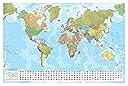
World Wall Map with Flags - Marco Polo - Laminated - 120cm (w) x 80cm (h) (Marco Polo Maps)
Product ID: 48611230
🏳️Flags, capitals & country codes
🖊️Dry-erase laminated surface
🗺️120x80 cm large format
Desertcart purchases this item on your behalf and handles shipping, customs, and support to Ecuador.
🌍 Map your world, master your space!
This large, laminated World Wall Map (120 x 80 cm) by Marco Polo combines vivid colors, detailed country flags, capitals, and codes at a 1:35,000,000 scale. Designed for classrooms, offices, or bedrooms, its dry-erase surface allows repeated writing and wiping, making it ideal for education, trip planning, or daily inspiration. Durable and ready to hang, it’s a trusted, practical tool for geography enthusiasts and professionals alike.

| Best Sellers Rank | 38,348 in Stationery & Office Supplies ( See Top 100 in Stationery & Office Supplies ) 349 in School Curriculum Resources |
| Customer Reviews | 4.5 out of 5 stars 176 Reviews |
S**F
Perfect for educating children
This is a beautiful map perfect for my boys bedroom. The flags on the bottom are fantastic and easy to identify. The durable finish is ideal for busy hands, very happy with this purchase. Great value for money.
M**H
Perfect for the classroom
Excellent map, large and informative for one of my classroom displays. Really pleased with it and reasonably priced.
A**L
It's a good map, but a little on the small side.
I like the map, but it's a little on the small side, therefore does not show all the cities. I should have bought one slightly larger, having said that it looks good and does the job.
A**R
Map
Was just what we needed
A**R
Know your world
Now when my kids ask me about any part of the Globe, all I do is go Close with them to this stunning laminated map. The beuty is that I can show them the country’s flag and Capital townnor City
D**R
Perfect world map
Great service, and good quality. Can highly recommend.
N**S
Great value
Great quality large size and has been incredibly helpful for A level history homework
M**E
its a world map
it shows you the whole world and more
A**R
Value for money!
I bought it for my class and it looks SO nice on the wall!! High quality and value for money.
C**2
Fantastic
This is a great quality map. It is nicely finished on glossy paper and came in a sturdy tube. I've been using it in my grade 2 class and it has held up well! The students loved that it had world flags on the bottom. Really happy with my purchase.
T**R
Huge, beautifully made, rolled map
Bought this to help with the kids' school work and very happy with this map. The size is nice and large as described, and is printed on high quality, glossy paper. It was packed rolled into a plastic tube (unlike some other maps which people said were folded and therefore with ugly creases) so it was super easy to open and put up. The map is based on the Van der Grinten projection so countries away from the equator tend to show exaggerated (particularly Greenland, Canada and Russia) but that is okay I suppose. The little flags at the bottom are a nice bonus and help learn the flags of the different countries. Overall a great map for anyone interested in geography
M**O
sieht super aus und aktuell (mit Südsudan)
ich kann die karte mit einem wasserlöslichen stift beschriften und verändern. so kann ich reisen gut planen und orte (mit herzen) markieren, die ich bereist habe. die antarktis wird mit allen länderflaggen bedeckt, aber mich stört das nicht.
M**H
Excellent Map
I picked this map because it's the only one I found with South Sudan on it. I also liked that the lines of longitude converge at the poles, suggesting that areas there are not as distorted as they are in Mercator projections. The map lists its projection as Van der Grinten which, while really only a minor improvement over Mercator, does at least indicate how map projections distort objects. Because the map repeats continuously to fill the whole area, it's easy to show how Alaska is one shape on the left and a different shape on the right. My only complaint is that it could be a little more detailed in terms of place names. Some minor place names are included where major place names are missing.
Trustpilot
2 weeks ago
1 month ago